Hunting for the past
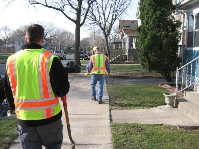
Over the next three years, Hennepin County surveyors like Rob Wied and Brian Johnson will be walking through neighborhoods like this one along 18th Ave. in southeast Minneapolis.
They wear blaze orange safety vests, and carry a shovel and a device called a magnetic locator. The locator finds magnetized metal buried in the ground.
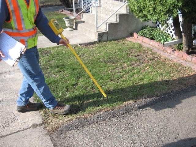
The locator emits a high pitched whine as Wied waves it over a section of grass near the driveway of a house. They find something -- some kind of a rusty metal pole sticking out of the ground by about an inch. But it isn't what they're looking for.
They need to find metal caps that mark where one lot begins and the other one ends. The markers are usually found a few feet from the sidewalk in the front yard buried several inches underground.
Create a More Connected Minnesota
MPR News is your trusted resource for the news you need. With your support, MPR News brings accessible, courageous journalism and authentic conversation to everyone - free of paywalls and barriers. Your gift makes a difference.
"Usually we just take a plug out of the ground so we don't disturb their soil too much," says Johnson, who's providing the shovel work today.
He says these markers are put in at the time a house is built, but sometimes are moved or removed by a fence builder or a landscaper.
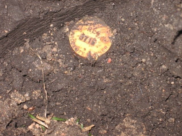
Sometimes the markers have plastic caps on top of them which contain an ID number obtained by a private surveyor. Most times, the markers are simple iron poles that have been pinched off at the top.
"So that's why we collect the points and the guys in the office check with what was originally platted to make sure that these are 40-foot lots," Johnson says.
"This is how everything fits together. It's kind of like a puzzle," says Wied.
When all the markers down this street are plotted they will lead surveyors to what they're really trying to find. That is the exact location of monument 0292424NE.
The name delineates the coordinates on a map set by the federal government's first survey of the area. Before it became Hennepin County and the city of Minneapolis, this was a township known as Number 29 north, range 24 west of the 4th principal meridian.
The monument is supposed to be a block away from where Rob and Brian are now - somewhere in the intersection of 18th Ave. SE and East Hennepin.
In 1847 this busy intersection was marsh land. The first federal surveyors planted a post here to mark the corner of a grid that splits the land into even one square mile sections.
Hennepin County Surveyor Bill Brown says the monuments were used by early developers to plan city streets and determine the boundaries of public and private land.
"Over the period of years, through street construction and such those points have become obliterated and lost," he says. "So our job is to go back and re-establish the location of the points."
The county and city began the joint venture last year, but the field work phase began earlier this year as soon as the ground thawed out.
Brown says when surveyors move downtown, he expects the locations of some of the original section corners will wind up being directly underneath high rise buildings. He says it's unlikely they will uncover any major conflicts in property boundaries. But he says it's important to re-establish the accuracy of the section corners as Minneapolis grows and changes over the next 150 years.
"The public land survey is a basis for all the legal descriptions in the county," says Brown. "So without those, we're not going to be able to move forward and re-describe and re-mark our property in the future if we don't have those points."
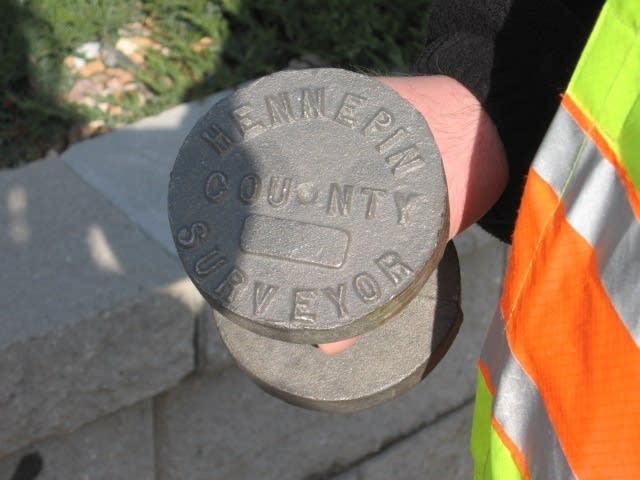
In the last phase of the project, the county will place about 160 new cast iron markers in the spots where the orginal monuments used to be.


