
April 8, 2011
Photos of Fargo-Moorhead, before and during flooding
Move the slider to compare images from before and during flooding in Fargo-Moorhead. The National Weather Service projects the river could reach 39-40 feet by Sunday.
1
Moorhead, MN, USA — These are views of downtown Moorhead, as seen from the top floor of the Moorhead Center Mall's parking ramp. River level before: 19 feet. River level when second photo was taken: 36 feet. (MPR Photos/Nathaniel Minor) link to this photo
2
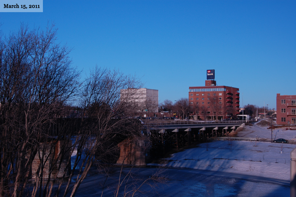
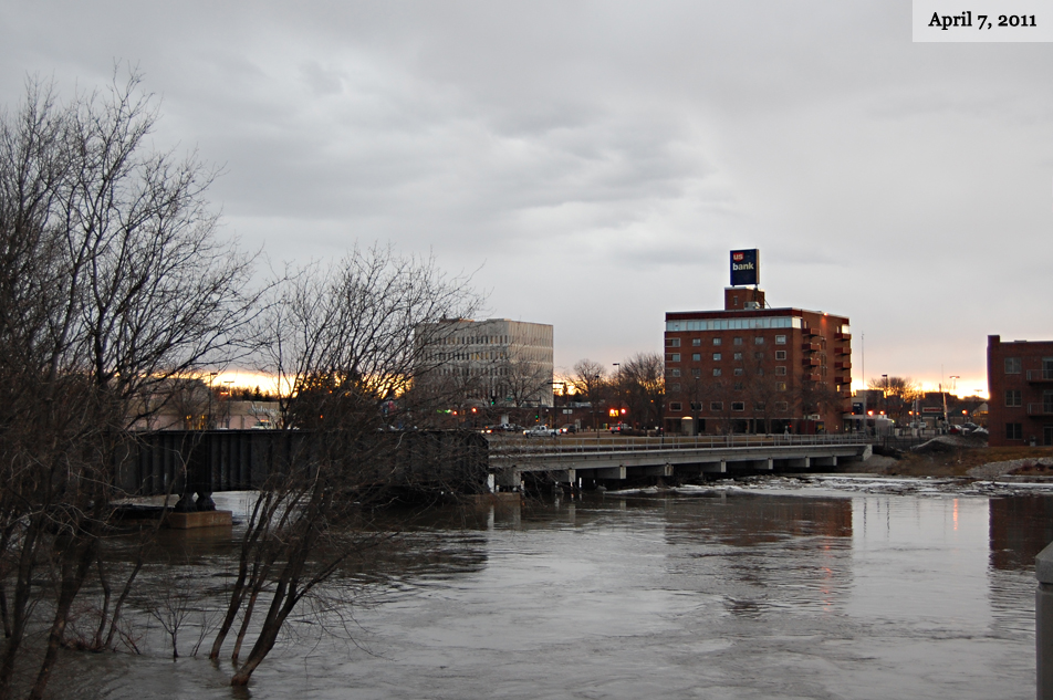
Moorhead, MN, USA — Moorhead City Hall and a US Bank branch are visible in these shots, taken from the Main Avenue Bridge. River level before: 19 feet. River level when second photo was taken: 35 feet. (MPR Photos/Nathaniel Minor) link to this photo
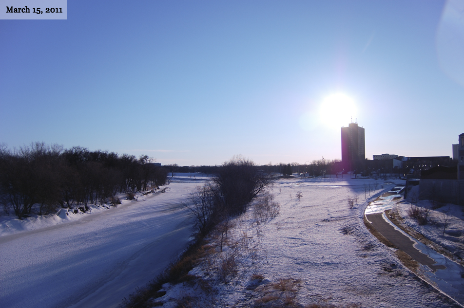
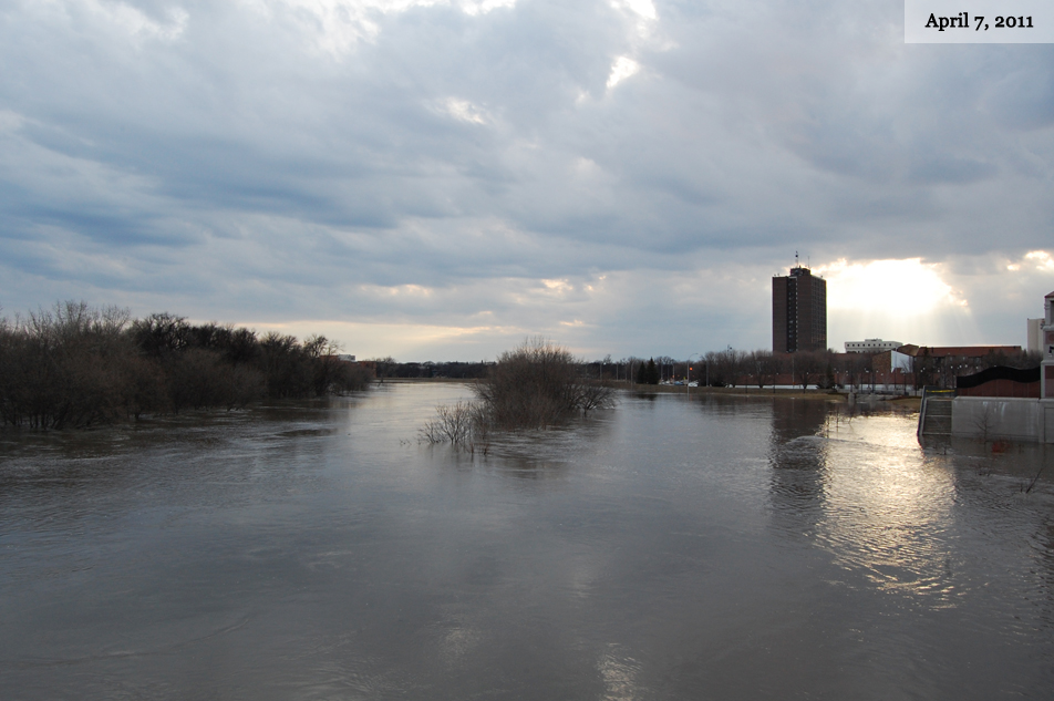
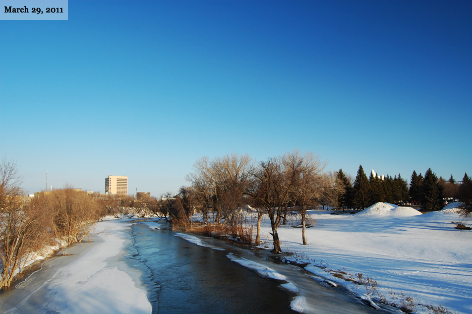
3
Fargo, ND, USA — The Fargo high-rise and the Red River are visible in these photographs, taken looking south on the Main Avenue Bridge. River level before: 18 feet. River level when second photo was taken: 36 feet. (MPR Photos/Nathaniel Minor) link to this photo
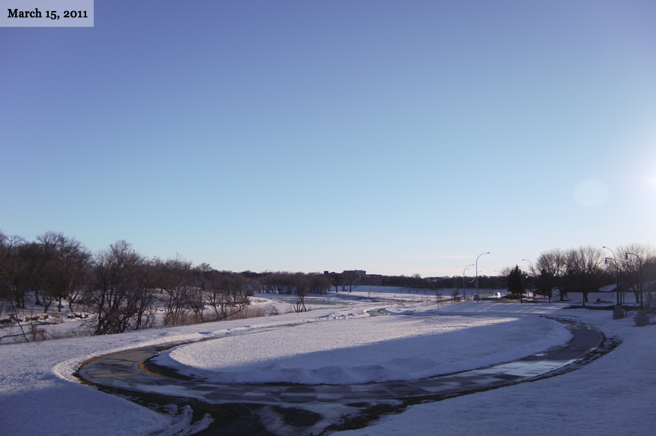
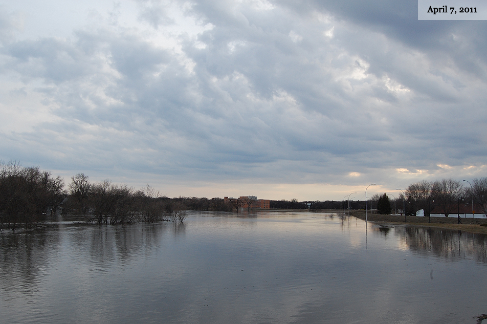
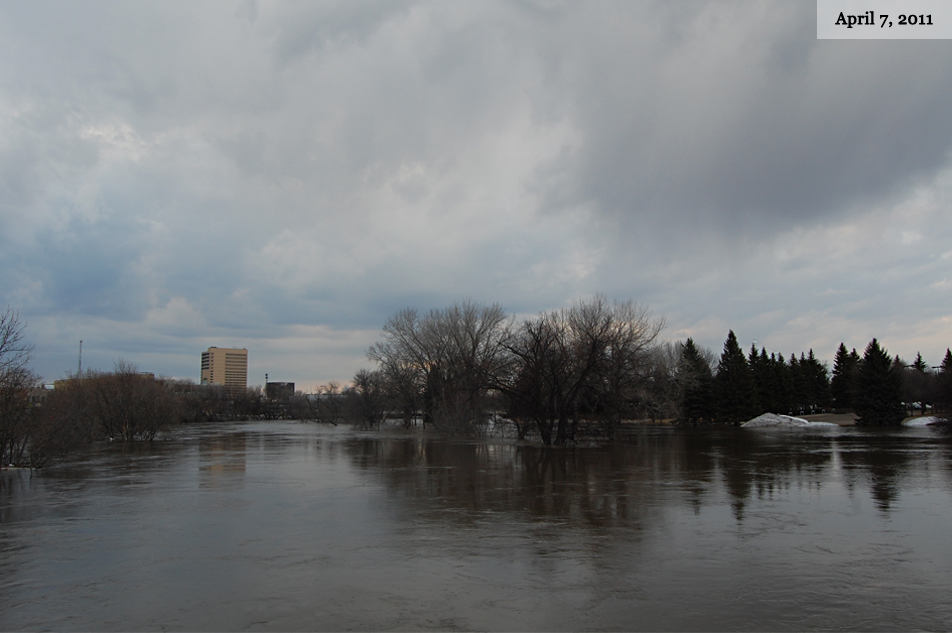
4
Fargo, ND, USA — Walking paths just south of the Main Avenue Bridge are visible in the first shot, whereas the water has completely covered them in the second. River level before: 18 feet. River level when second photo was taken: 36 feet. (MPR Photos/Nathaniel Minor) link to this photo
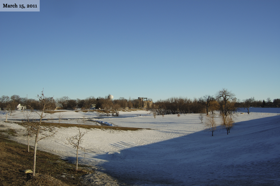
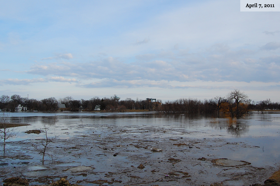
5
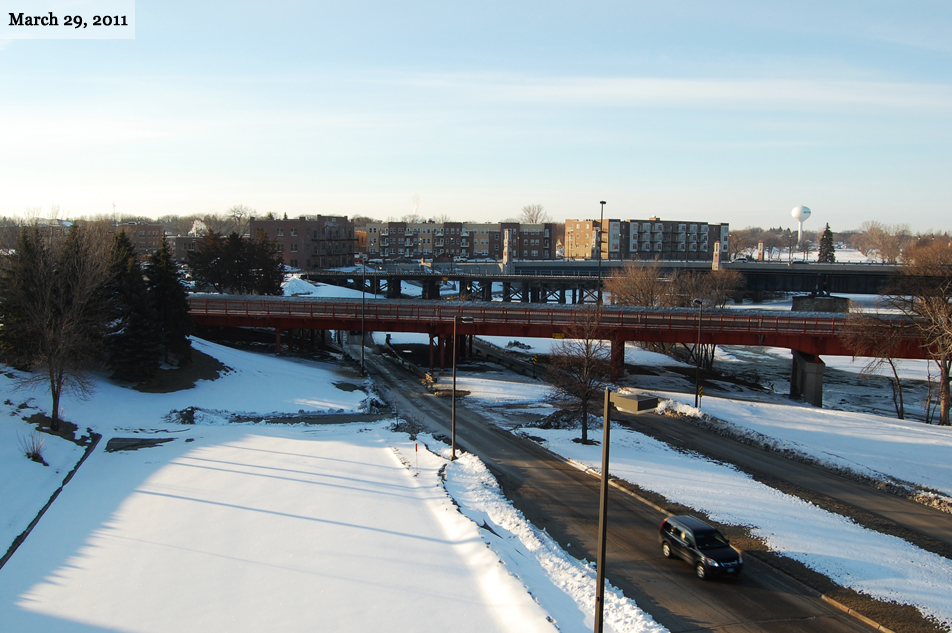
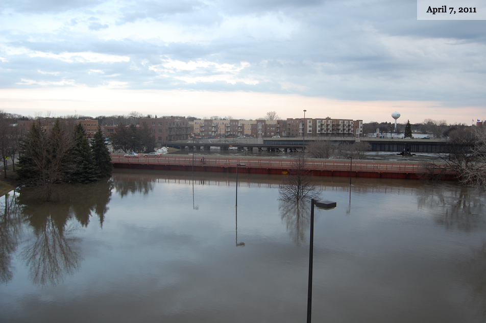
Fargo, ND, USA — This is a view from Dike Park East in Fargo, looking east toward Moorhead. River level before: 18 feet. River level when second photo was taken: 36 feet. (MPR Photos/Nathaniel Minor) link to this photo
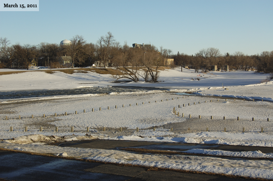
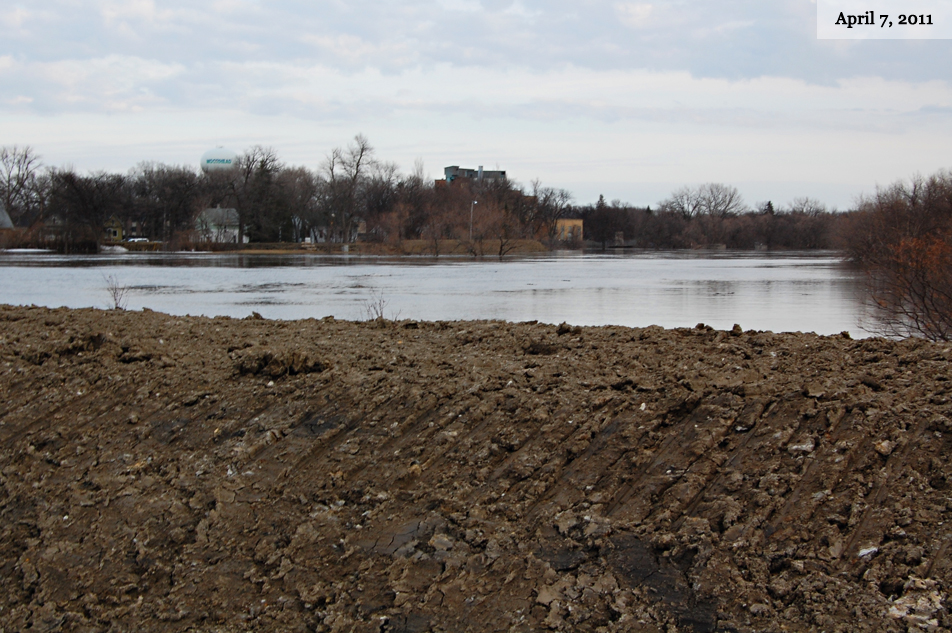
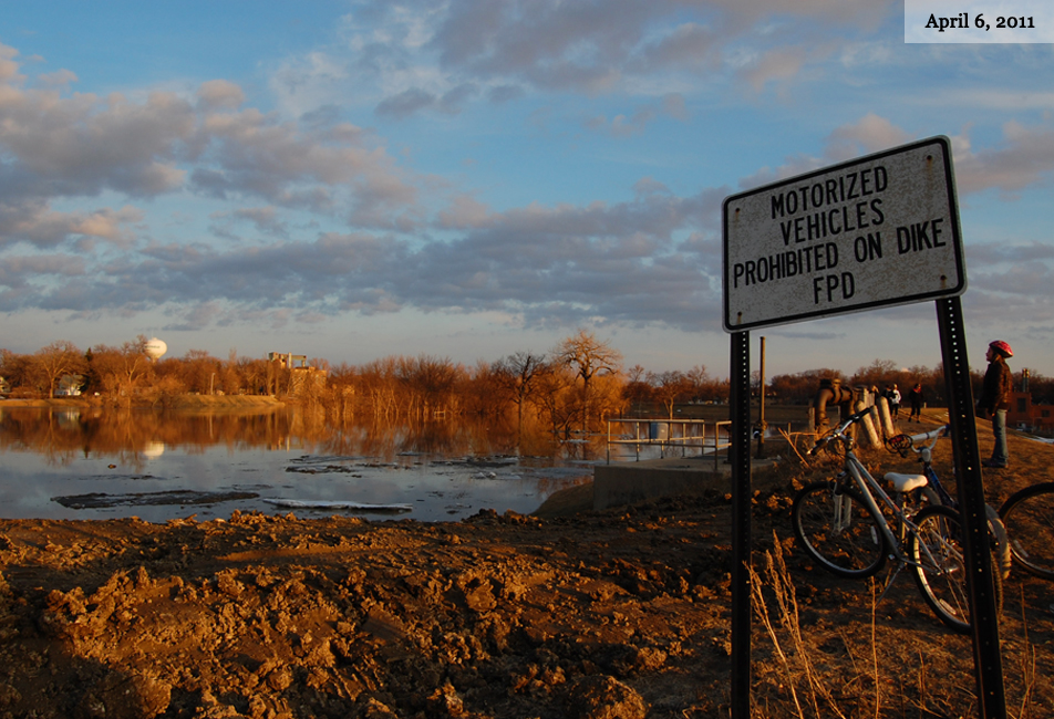
6
Fargo, ND, USA — This is a view from Dike Park East, looking east toward Moorhead. In the second photo, the top of a temporary clay levee sitting on 2nd Street South is visible. River level before: 18 feet. River level when second photo was taken: 36 feet. (MPR Photos/Nathaniel Minor) link to this photo
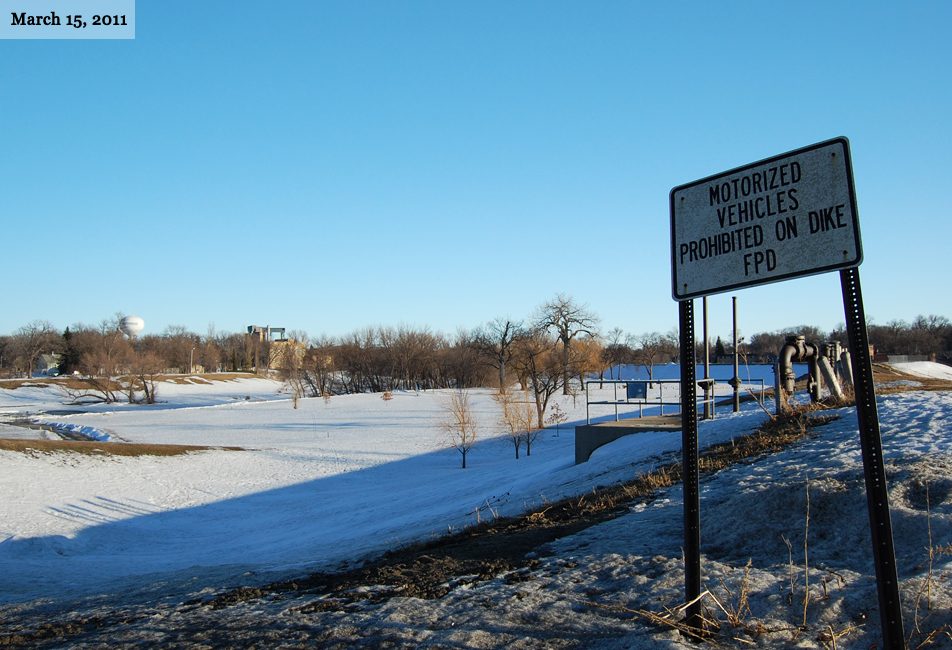
7
Fargo, ND, USA — This is a view from Dike Park East in Fargo, looking east toward Moorhead. The dike at right is permanent. River level before: 18 feet. River level when second photo was taken: 33 feet. (MPR Photos/Nathaniel Minor) link to this photo
8
Fargo, ND, USA — Moorhead, MN, USA — In these photographs taken from the Center Avenue Bridge, downtown Fargo is visible. River level before: 18 feet. River level when second photo was taken: 36 feet. (MPR Photos/Nathaniel Minor) link to this photo
View other Minnesota in Photos Slideshows:
Bear research in northwestern Minnesota
Minnesota black bears are on the move in northwest Minnesota. Bears are expanding their range out of forested areas, into farmland. Researchers are trying to learn more about how and why these bears are adapting to a new habitat where bears traditionally did not live.
'Sand bag central' opens in Fargo
Efforts are underway in Fargo, N.D., to fill 3 million sandbags in anticipation of spring floods.
Snow sculptures come down
Heavy equipment demolishes the snow sculptures created during the Winter Carnival.
The Luminary Loppet
Thousands of luminaries marked the course on Lake of the Isles for the Luminary Loppet.
Beargrease Sled Dog Marathon
Photos from the start of the 2011 John Beargrease Sled Dog Marathon.
St. Paul Winter Carnival
The St. Paul Winter Carnival is featured dozens of activities to help celebrate the season.
U.S. Pond Hockey Championships
People from all over the country braved the cold for the U.S. Pond Hockey Championships.
2011 Minn. Legislature convenes
The Minnesota Legislature convened under full GOP control for the first time in 38 years.
Mark Dayton's inauguration
Scenes from the inauguration of Mark Dayton in St. Paul, Minn. on Jan. 3, 2011.
Photos of the year: Part 3
Part 3 of our look back at some of MPR's most memorable images from 2010.
More slideshows »
- Become a Member
- Member Connect Accounts
- Leadership Circle
- Sustaining Members
- Member Discounts
- Become a Sponsor
- Tax Information
- Planned Giving
- Vehicle Donation
- Donate Stock
- Mobile
- Newsletter
- RSS Feeds
- Podcasts
- Blogs
- Videos
- HD Radio
- Hourly Newscast
- Find Programs