Photos: Red River flooding from the air
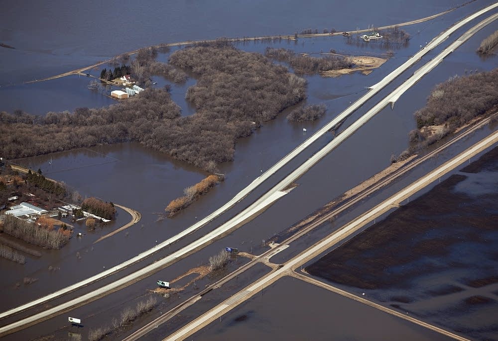
Floodwaters are making travel difficult in much of the Red River Valley as dozens of roads are under water, including a portion of Interstate 29 north of Fargo. This image was taken near Harwood in Cass County on Monday, April 11, 2011.
MPR Photo/Ann Arbor Miller
The water has reached record levels north of Fargo-Moorhead and dozens of roads are under water making travel nearly impossible. MPR News sent photojournalist Ann Arbor Miller to get an aerial view of the flooding in the Red River Valley.
Gallery


Create a More Connected Minnesota
MPR News is your trusted resource for the news you need. With your support, MPR News brings accessible, courageous journalism and authentic conversation to everyone - free of paywalls and barriers. Your gift makes a difference.